Oman
Bordered to the northwest by the United Arab Emirates, to the west by Saudi Arabia, and to the southwest by Yemen, and sharing marine borders with Iran and Pakistan, the Sultanate of Oman occupies the whole southeastern corner of the Arabian Peninsula.
It is a country where its boundaries defined by nature at its most extreme and frequently its most majestic. Its 1,700 km coastline overlooks the Sea of Oman and the Persian Gulf, known in ancient times as the Erythraean Sea, and protects an interior that rises from flat coastal plains to a central massif averaging 1,500m above sea level and reaching at its highest the 3,000m peak of Jebel Al-Akhdhar.
Further inland, the mountains fall away to the west, descending into a desert which merges with the Rub’ Al-Khali, or Empty Quarter, of Saudi Arabia.
Separated from the main land mass of the Sultanate by the United Arab Emirates is the Omani enclave of Musandam on the Strait of Hormuz, the strategic narrow passage through which the waters of the Persian Gulf empty into the Sea of Oman on their way to the Indian Ocean.
From the country’s central massif, seasonal waters pour down onto the green plains below along steep gorges, and since ancient times Omanis have harvested these waters and channelled them through intricate manmade aflaj or water channels to support plantations of date, banana and coconut palm, as well as a variety of grains, fruits and vegetables
Along the coast, fishing has been an important source of sustenance and revenue from the time of the earliest human settlement in Oman, identified at Wattia near present day Muscat and dating to the 10th millennium BC.
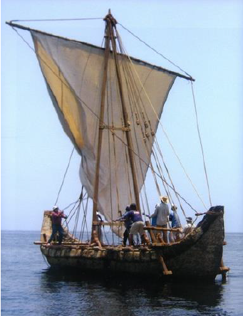
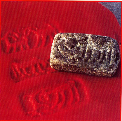
From the 1st century AD Periplus of the Erythraean Sea it is known that vessels from the distant port of ‘Omana’ (possibly ancient Sohar or Muscat) had reached the southern shores of China. Even earlier, Agatharchides, who lived in Egypt in 120 BC, wrote that the “Omanis have arrived on the Indian coast.” At this time Oman’s merchant fleet was already one of, if not the, strongest and largest in the world.
Oman was a thriving country in mediaeval times and its prosperous citizens had direct access to the most exotic of the luxuries arriving at its ports: silk brocades and porcelain, perfumes and precious gemstones found their way into the mansions of Muscat and Sohar. A fashion for classic blue and white Ming chinaware drove soaring demand in the 14th century.
The geometric themes of Islamic art spread west and east along the trade routes, inspiring ceramists, engravers and architects to soaring new heights of creativity and beauty.


 | Country: Oman | Copyright: UNESCO")